
Four Corners Free Land
A Hidden Gem for Adventurers

Nestled in the Southwestern United States, the Four Corners region is a unique geographical marvel where the borders of Colorado, New Mexico, Arizona, and Utah converge. This remarkable spot is the only place in the country where you can stand in four states at once. It holds a rich tapestry of cultural and historical significance, with the Four Corners Monument marking this intersection.
The area is not just a point on a map; it is steeped in the heritage of indigenous tribes, particularly the Navajo Nation, which governs part of the land. The region resonates with echoes of the Ancestral Puebloans and other tribal groups who once flourished here, leaving behind trails of ancient civilizations. Visitors are drawn to its monumental landscapes, including sites like Mesa Verde and Chaco Canyon, which are testaments to the area's storied past.
For those with a spirit of adventure and a desire to explore, the Four Corners offers a sense of freedom and connection to the vast American Southwest. Whether you're fascinated by the historical richness or the sheer novelty of standing in multiple states simultaneously, this singular location promises an intriguing journey through time and geography.
Historical Background

An important historical overview of Four Corners spans ancient civilizations, the surveying efforts that defined its borders, and the establishment of the monument marking this unique quadripaoint.
Ancestral Puebloans and Native Tribes
The Four Corners region has been home to various Native American tribes for thousands of years. The Ancestral Puebloans are among the earliest known inhabitants, building intricate stone and adobe structures. These ancient people, along with the Navajo and Ute tribes, have left a rich cultural and archaeological legacy.
Artifacts found in the area include pottery, tools, and remnants of the pueblos that give insight into their daily lives and societal structures. Today, the region is predominantly inhabited by the Navajo Nation and Ute tribes, including the Ute Mountain Ute Tribe.
Surveying the Four Corners
The precise surveying of the Four Corners area began after the Mexican-American War when the United States acquired large territories from Mexico. Surveyors played a key role in defining the exact point where Arizona, Colorado, New Mexico, and Utah converge at latitude 37° N.
Significant efforts were made to ensure accurate measurements. Granite and sandstone markers were used to demarcate boundaries. The U.S. Government conducted detailed surveys to establish these borders, utilizing teams of surveyors to navigate and chart the rugged terrain.
Establishment of Four Corners Monument
The Four Corners Monument was officially established to mark where the four states meet. This monument, set up by the Colorado Territory and other entities, consists of a concrete pad with embedded markers, inscriptions, and the seals of the four states. It also includes flags representing the four states and various tribal nations.
Located within Navajo Tribal Park, the monument is a symbolic and physical representation of the area's diverse history. The spot is not only a geographical curiosity but also a significant cultural landmark, featuring an inscription: "Four states here meet in freedom under God." The monument stands as a testament to historical surveying efforts and the rich indigenous heritage of the region.
Geography and Geological Features
The Four Corners region is unique for its distinctive geological formations and the convergence of four U.S. states. It encompasses a variety of landscapes including plateaus, canyons, and significant historical sites.
The Colorado Plateau
The Colorado Plateau stretches across Arizona, Utah, Colorado, and New Mexico. This area is marked by vast expanses of high desert, dramatic rock formations, and cliffs. Known for its layered sedimentary rocks, the plateau displays an array of colors and textures derived from ancient ocean beds, lakes, and deserts.
Erosion has sculpted the plateau into mesas, buttes, and intricate canyon systems. The Grand Canyon, located on the plateau’s western edge, serves as a prominent example of this geological process. Many national parks in this region, including Canyonlands, Capitol Reef, and Bryce Canyon, showcase this natural artistry.
Monument Valley and Tribal Parks
Monument Valley, on the Arizona-Utah border, is characterized by its striking sandstone buttes and mesas, some rising as high as 1,000 feet. This landscape is iconic due to its frequent depiction in films and media. It is part of the Navajo Nation, which manages the Monument Valley Navajo Tribal Park.
Visitors to Monument Valley experience a landscape that is not only geologically significant but also culturally rich. The tribal parks preserve natural beauty while respecting the heritage of Indigenous peoples. Traditional Navajo guides offer tours, providing insights into both the geological history and the cultural significance of the formations.
Canyons and National Monuments
The Four Corners region is home to numerous canyons and national monuments. Mesa Verde, in Colorado, is famed for its cliff dwellings constructed by the Ancestral Puebloans. Chaco Canyon in New Mexico was a major center of Puebloan culture, featuring extensive ruins.
Canyon de Chelly, also managed by the Navajo Nation, offers dramatic sandstone cliffs and ancient ruins. This canyon holds both natural and historical intrigue, with its towering formations and well-preserved archeological sites. Each of these locations provides a different glimpse into the geological forces at play, as well as the human history intertwined with the land.
Cultural Significance
Four Corners is a place rich in cultural heritage, deeply rooted in the traditions of Native American tribes. The region serves as a vital meeting point for tribal interactions and showcases exceptional art and craftsmanship.
Four Corners as a Tribal Meeting Point
For centuries, Four Corners has been a significant meeting place for several Native American tribes, including the Navajo Nation, Ute Mountain Ute Tribe, and the Hopi. These tribes have used the location for gatherings, trade, and ceremonial purposes.
Events at Four Corners are imbued with deep cultural meaning. Annual gatherings and festivals bring together diverse tribal members, fostering a sense of unity and shared heritage. This site also serves as a venue for important cultural ceremonies that reinforce traditions and ancestral connections.
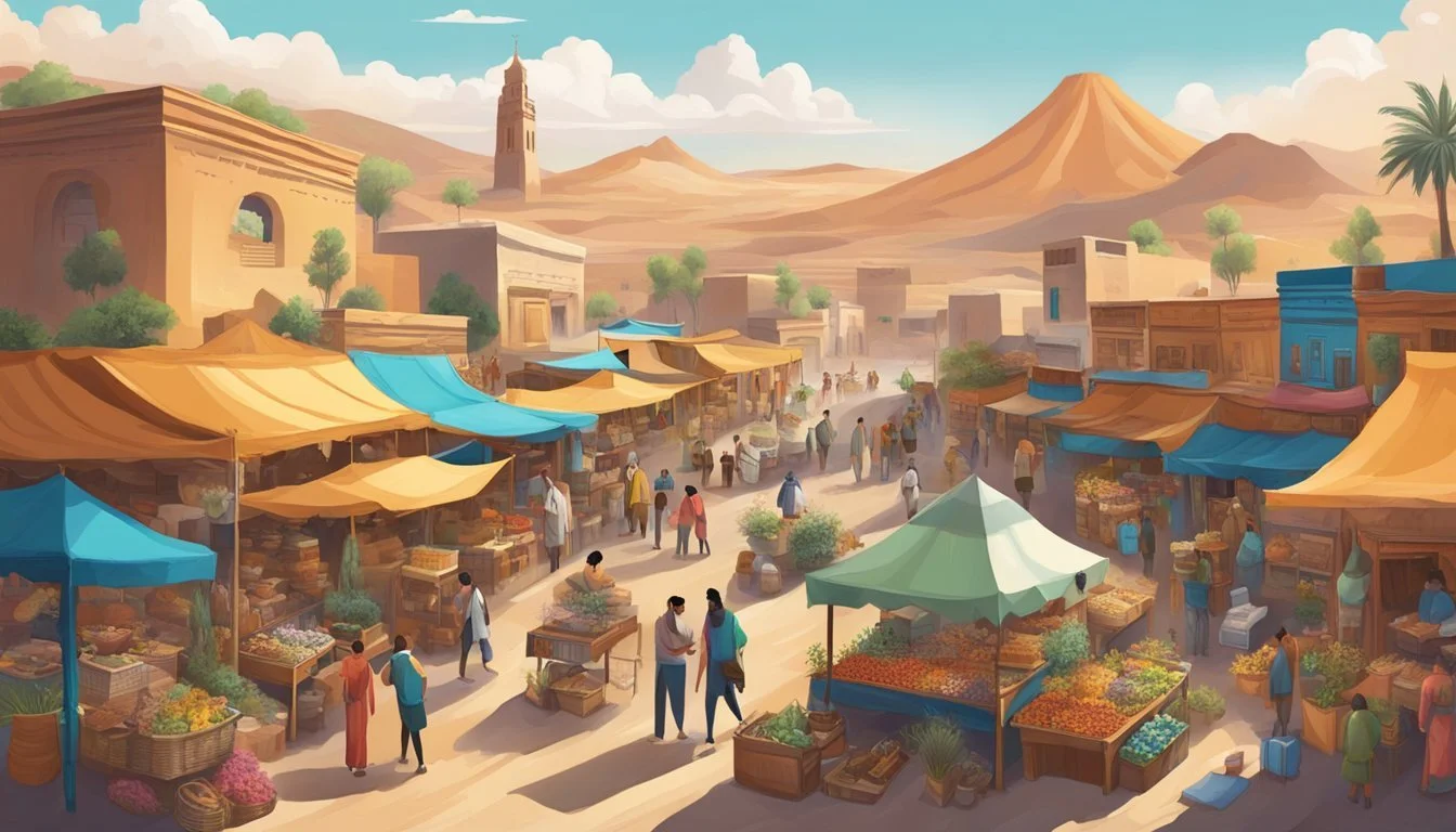
Art and Craftsmanship in the Region
The Four Corners region boasts a rich tradition of Native American art and craftsmanship. Navajo, Hopi, and Ute artisans are renowned for their intricate pottery, jewelry, and weaving techniques.
Navajo Jewelry: Known for its silverwork and turquoise inlays, Navajo jewelry plays a central role in cultural expression and economic sustenance.
Hopi Pottery: Hopi artists are celebrated for their pottery, which features traditional methods and symbolic designs passed down through generations.
Through markets and exhibitions, these art forms not only preserve cultural heritage but also provide insights into the history and values of the tribes. Local galleries and craft fairs offer visitors the opportunity to engage with and appreciate the diverse artistic practices cultivated over centuries in the Four Corners area.
Tourism and Visitor Information
Four Corners offers a unique blend of cultural heritage, historical landmarks, and practical amenities. It’s essential to understand the best times to visit, key landmarks like the Four Corners Monument, and what local amenities are available.
Best Times to Visit and Weather
The best times to visit Four Corners are during the spring and fall. The weather is more moderate, making outdoor activities pleasant. Summer can be hot and dry, while winters can bring snow and colder temperatures, especially at higher elevations.
Average temperatures in the spring range from 60°F to 80°F (15°C to 27°C). Fall temperatures are similar, making both seasons ideal for travel. Peak season is typically during these periods, so expect more tourists and potentially higher prices for accommodations.
Visiting Four Corners Monument
The Four Corners Monument marks the unique spot where Arizona, Colorado, New Mexico, and Utah meet. There is an entry fee, which can be paid by credit card or cash. The landmark itself is a popular spot for photographs and offers a small vendor market where visitors can purchase local crafts and souvenirs.
The Visitor Center at the monument provides information and services, including restrooms and snack vendors. It is advisable to check current opening hours and health guidelines before planning your visit. The monument is somewhat remote, so plan your travel route in advance.
Local Amenities and Accommodations
Accommodations in Four Corners range from campgrounds to hotels. Many visitors prefer staying in nearby towns such as Cortez, Farmington, and Bluff, which offer more extensive services. Most accommodations provide basic amenities like electricity, Wi-Fi, and food options.
For those traveling by vehicle, ensure you have enough fuel, as services can be sparse in some areas. Some campgrounds offer RV hookups and tent sites. Dining options are varied, with local restaurants offering traditional Native American cuisine and standard American fare.
Facilities like grocery stores, gas stations, and medical services are more commonly found in the surrounding towns. It is advisable to plan ahead and know the locations of these amenities before embarking on your trip.
Economic Aspects
The Four Corners region represents a unique blend of economic activities, driven by a mixture of tourism, trade, and commerce. Each sector plays a critical role in shaping the local economy and influencing the livelihoods of residents.
Tourism Impact on Local Economy
Tourism significantly contributes to the local economy, drawing visitors drawn to the unique geographical feature where Arizona, New Mexico, Colorado, and Utah meet. This influx affects accommodations, retail businesses, and other service providers. Hotels, motels, and local hostels see heightened occupancy rates, especially during peak seasons. Vendors selling native crafts, souvenirs, and local cuisine benefit from increased foot traffic. Services related to tourism, like guided tours and adventure activities, also experience higher demand.
Fees collected from entry points to national monuments and parks within the Four Corners boost local government revenues. Seasonal vendors often set up stalls, adding to the vibrancy of the local commerce. Special events and festivals further amplify tourism, injecting additional capital into the economy.
Trade and Commerce Within Four Corners
Trade and commerce within the Four Corners involve a diverse range of activities including agriculture, retail trade, and local manufacturing. The region's scenic and rugged terrain supports various industries. Local farmers and artisans often rely on regional and interstate trade to sustain their businesses.
Controlled Environment Agriculture is becoming increasingly feasible due to economic stressors and environmental concerns. This shift opens up opportunities for vendors specializing in hydroponics and aquaponics equipment and supplies. The area’s historical reliance on the coal industry is transitioning, focusing more on sustainable and diversified economic activities. Bi-weekly Development Review Committee meetings bring together key stakeholders to streamline projects and enhance economic prospects, ensuring the region adapts effectively to contemporary challenges and opportunities.
Legislation and Policies

The Four Corners region, where Arizona, Colorado, New Mexico, and Utah meet, is subject to a complex web of laws and regulations. These policies balance tribal, state, and federal jurisdictions while emphasizing the conservation and protection of cultural heritage.
Tribal, State, and Federal Jurisdictions
The Four Corners area encompasses a diverse legal landscape, involving multiple Tribal Nations, state governments, and federal entities. Each group holds specific jurisdictional powers, often leading to overlapping authorities.
For instance, the Bureau of Indian Affairs plays a crucial role in managing affairs on tribal lands, providing service and oversight. States also exercise significant control over land use, though their authority can sometimes clash with federal and tribal rights.
Surveyors and land management agencies, like the U.S. Forest Service, ensure that boundaries and land titles are in accordance with both federal law and state regulations. Congress has passed various acts to mediate these relationships, balancing development and respect for tribal sovereignty.
Conservation and Cultural Protection
Conservation and the protection of cultural resources in the Four Corners region are governed by numerous policies aimed at preserving both the natural environment and the rich historical heritage of the area.
Tribal lands, often rich in cultural artifacts, are protected through laws that limit access and ensure that sacred sites are preserved. The U.S. Government and states collaborate on conservation efforts, often enforcing strict regulations through national monuments and protected areas, managed by agencies like the Forest Service.
Legislation such as the National Historic Preservation Act ensures that developments do not compromise significant archaeological sites. Through these measures, both environmental integrity and cultural heritage are safeguarded for future generations.
Infrastructure and Access

Four Corners Free Land prioritizes infrastructure and access within its regions to ensure residents can thrive. Key areas of focus include transport and road networks for connectivity and public services and utilities to support daily living needs.
Transport and Road Networks
Four Corners benefits from a well-maintained network of roads and transport options that connect key locations such as Chinle, Window Rock, and Teec Nos Pos. State highways and local roads crisscross Kayenta, facilitating smooth travel for residents and visitors.
The Arizona Department of Transportation and similar agencies direct resources to maintain these roads, making travel safe and efficient. Public transit services run regularly, keeping even remote areas reachable. Freight transport routes also support local businesses and agriculture, ensuring that goods move quickly and efficiently throughout the area.
Public Services and Utilities
Water provision and electricity are managed by regional utilities, ensuring consistent supplies to households across Four Corners. Investments in modern infrastructure guarantee that residents in places like Chinle and Window Rock have access to safe drinking water and reliable power.
Public services such as education and healthcare are readily available. Local clinics and schools are well-equipped and staffed, ensuring essential needs are met. Infrastructure projects continually update and expand these services, focusing on underserved areas to ensure uniform access to all residents.
Contemporary Issues and Challenges
"Four Corners Free Land" faces significant issues in land management and cultural preservation. Understanding these problems provides insight into the area’s difficulties and the efforts to overcome them.
Land and Resource Management
Land and resource management in Four Corners is a critical issue. The region consists of rural areas with diverse needs, including agriculture, conservation, and urban development. The Bureau of Indian Affairs plays a role in overseeing relevant policies, especially on tribal lands.
Water scarcity and disputes over water rights affect agricultural productivity and residential needs. Resource extraction, like mining and drilling, brings economic benefits but also environmental concerns. Monument closures and restricted trail access due to land management disputes have also been a source of local tension.
Cultural Heritage and Preservation Efforts
Preserving cultural heritage is essential for the region’s numerous Tribal Nations. These efforts involve maintaining historical sites, protecting artifacts, and supporting traditional practices. Chinle and other rural areas hold significant cultural landmarks requiring dedicated preservation efforts.
Flags and emblems representing various tribal identities must be respected in these initiatives. Collaboration with federal and state agencies ensures the protection of culturally significant locations. However, funding and resource allocations for these projects often fall short. The balance between preserving heritage and accommodating modern development continues to challenge both local communities and administrative bodies.
