
USDA Hardiness Zones in Ohio
Navigating the State's Gardening Map

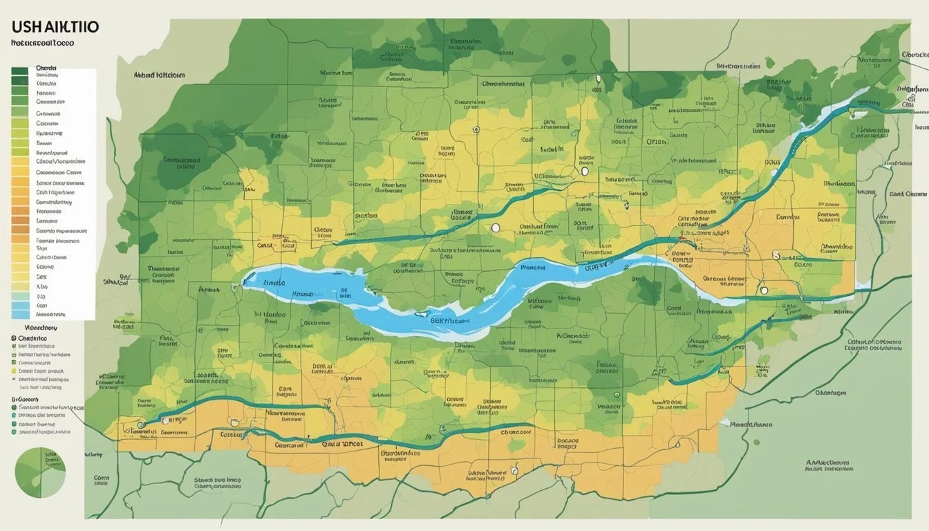
Understanding the USDA Plant Hardiness Zone Map is essential for gardeners and growers in Ohio. This map, which categorizes regions based on their average annual extreme minimum winter temperature, provides a useful guideline for determining which plants are most likely to thrive in a particular location. The USDA zones in Ohio range from 5a-20°F to -15°F, extending to 7a 0°F to 5°F.
The state of Ohio presents a diverse climate where a variety of plants can grow, depending on the specific hardiness zone. Observations from weather data collected over several decades by the USDA have been translated into the most recent version of the map, ensuring a more accurate representation for the current growing conditions. Gardeners in Ohio refer to the Plant Hardiness Zone Map to inform their choices in planting perennials, shrubs, and trees, with the aim of achieving optimal growth and survival rates throughout the changing seasons.
The USDA continually updates the Plant Hardiness Zone Map to reflect changing climate patterns, with the latest release at the end of 2023. These updates offer invaluable insights for Ohio's agriculture and landscaping, allowing for the adaptation of planting strategies in line with the evolving environment. Adherence to these zones is a cornerstone of a successful growing season for both amateur and professional horticulturists in the state.
Understanding USDA Hardiness Zones
USDA Hardiness Zones are critical in guiding gardeners and growers in Ohio to understand which plants can endure the local climate. These zones are defined by the USDA Plant Hardiness Zone Map and are invaluable for deciding plant survival and growth prospects.
Historical Development
The USDA ARS (United States Department of Agriculture Agricultural Research Service) developed the USDA Plant Hardiness Zone Map to provide a reliable guide for categorizing locations based on the lowest temperatures they can expect. Historically, this involved significant research and data compilation from numerous weather stations. From its beginnings, the map has been a trusted resource for determining the potential success of plant survival across the United States.
Interpreting the Zones
The map divides the country into zones based on average annual extreme minimum winter temperatures. Each zone represents a 10-degree Fahrenheit range, further split into 5-degree Fahrenheit half zones, designated as "a" (colder) and "b" (warmer) within each 10-degree bracket. For instance, Ohio features zones such as 5a and 6b, each indicating a different range of temperatures and corresponding plant hardiness expectations.
The Importance of Hardiness Zones to Gardeners and Growers
For gardeners and growers in Ohio, understanding and applying information from the USDA Plant Hardiness Zone Map is vital for the survival of plants. By selecting plants suited for the specific zone of their location, stakeholders can better ensure seasonal survival and reduce the risks associated with unexpected temperature variations. These zones offer detail not only about what plants can survive, but also about how plants can potentially thrive in an area, making them an indispensable tool for successful horticulture and agriculture.
USDA Hardiness Zones in Ohio
The USDA Hardiness Zone Map provides essential information to Ohio gardeners and growers, detailing which plants are suited to thrive based on localized winter temperature zones.
Zone Distribution and Characteristics
Ohio's landscape features a range of USDA Hardiness Zones, from 5a to 7a. These zones guide plant selection by indicating the average annual extreme minimum winter temperature. Here is a breakdown:
Zone 5a: Temperatures fall between -20°F to -15°F.
Zone 5b: Temperatures range from -15°F to -10°F.
Zone 6a: Winter temperatures hover between -10°F to -5°F.
Zone 6b: A slightly warmer climate with temperatures from -5°F to 0°F.
Zone 7a: The mildest area, with temperatures between 0°F to 5°F.
The delineation of these zones has been refined using GIS technology, providing precise geographic information to support plant hardiness decisions.
Ohio-Specific Planting Guidance
When selecting perennials or contemplating the start of a new garden, Ohioans should consult the latest Hardiness Zone Map for guidance tailored to their specific location. For instance:
Northern Ohio typically falls within Zones 5a to 5b, favoring plants that can withstand colder temperatures.
Southern Ohio, enjoying zones 6a to 7a, allows for a broader selection of plant species less cold hardy.
Incremental shifts in zones, likely due to climate change, point to a trend towards milder winters. Gardeners and growers should watch for these trends as they may influence future plant selection. It is advisable to use these zones as a framework but also consider microclimates, soil conditions, and other environmental factors.
Digital Advancements and Resources

The USDA has made significant strides in incorporating digital technology to enhance the accuracy and usability of the Plant Hardiness Zone Map (PHZM). These advancements provide gardeners, researchers, and agricultural professionals with online tools to make informed planting decisions.
GIS and the PHZM
Geographic Information Systems (GIS) technology has been instrumental in updating the PHZM. Through GIS, the USDA integrates spatial information on temperature, elevation, and other climatic variables, offering far more precise and detailed maps than previous versions. Users can now access high-resolution data tailored to specific geographical locales, thanks to the meticulous work of USDA ARS research programs.
USDA ARS Online Tools
The USDA's Agricultural Research Service (USDA ARS) provides a suite of online tools essential for understanding regional plant hardiness. The USDA ARS website houses these user-friendly digital resources, which enable users to locate their hardiness zone with a simple entry of their zip code. These tools benefit from ongoing research and represent the USDA's commitment to disseminating authoritative and actionable data derived from extensive studies.
Utilizing the Interactive Map
The Interactive Map has transformed how individuals interact with the USDA Plant Hardness Zone Map. Users can pinpoint their exact plant hardiness zone by entering a zip code and can study the intricacies of local climate effects with the click of a mouse. The map not only provides a visual representation of hardiness zones but also offers critical information such as elevation, key to understanding microclimate conditions. The National Map is a prime example of an easily navigable platform, fostering an intuitive experience for all levels of users.
Climate Influences on Hardiness Zones
The classification of USDA Hardiness Zones is directly affected by long-term temperature data, which reflects the influence of global climate change. In Ohio, these shifts become evident as the zones change to reflect warmer temperatures.
Impact of Global Climate Change
Global climate change has led to a discernible pattern of warming, which is reflected in the adjustments to hardiness zones. The updated USDA Plant Hardiness Zone Map indicates a significant shift in zones, with much of Ohio now categorized in areas previously considered too cold. This is a direct consequence of rising average temperature levels.
Analyzing Temperature Data Trends
Hardiness zones are determined by analyzing 30-year averages of extreme minimum temperatures. Data gathered from weather stations across Ohio show a trend towards warmer temperatures, signifying a northward shift in plant viability. The use of detailed temperature data ensures that these zones provide a current and relevant guide for gardeners and farmers in the region.
Implications for Agriculture and Gardening
The recent update to the USDA Plant Hardiness Zone Map has important ramifications for Ohio's agriculture and horticulture, including the management of crop insurance, combatting exotic pests, and guiding the selection of plant species for optimal survival.
Crop Insurance and Risk Management
With the updated USDA hardiness zones, growers and the Risk Management Agency can more accurately assess environmental risks, tailoring crop insurance policies to reflect the shifting climatic realities. Ohio gardeners can use the zone information for better risk management, anticipating potential weather challenges that could affect plant health and crop yields.
Addressing Exotic Weeds and Insects
Adapting to the updated zone data, agriculturalists now must be ever-vigilant of the possibility of exotic weeds and insects that thrive in warmer climates. This vigilance is crucial for maintaining Ohio's ecosystems and agricultural productivity. The introduction of new species may require updated management plans and research from the Agricultural Research Service to safeguard local flora.
Plant Survival and Selection
For gardeners and growers, understanding the nuances of Ohio's placement on the USDA Plant Hardiness Zone Map is essential for the selection of perennial plants and trees that can survive local winter extremes. The new zoning helps in forecasting plant survival rates and informs the selection process, ensuring a greater chance for success in gardens and landscapes across the state.
Regional Analysis and Local Variations
The hardiness zones in Ohio reflect a diverse range of climates, showcasing local variations due to factors such as elevation and urban heat effects. This nuanced understanding is crucial for Ohio's gardeners and growers.
Ohio Cities and Hardiness Zones
Akron: Primarily in zone 6a, indicating winter lows of -10°F to -5°F.
Cincinnati: Falls mainly within zone 6b, with lows of -5°F to 0°F.
Ohio cities exhibit diverse microclimates, impacting the survival and thriving conditions for plants. Urban areas may experience slightly warmer climates due to the heat island effect, making them conducive for different plant varieties than rural surroundings.
Mountain Regions and Elevation Factors
High elevation areas: Likely to be cooler, thus fitting into a colder hardiness zone.
Lower areas: Typically warmer, aligning with a warmer zone.
Elevation plays a pivotal role in Ohio's regional climates, and geographic information systems (GIS) often capture these topographical influences on hardiness zones.
Zonal Boundaries Shift Over Time
Ohio's zonal boundaries have shifted over recent years, denoting changes in climate patterns. Zone map updates take into account long-term climate data and predictive research models to reflect these alterations.
Local Tips for Gardeners and Growers
Microclimate consideration: Pay attention to your specific location within the hardiness zone for the best planting results.
Zonal adaptation: Choose plants rated for your specific zone or one zone colder for increased survival rates.
For local gardeners and growers, understanding the intricacies of Ohio's climate zones and their updates is essential for cultivating plants optimally.
Frequently Asked Questions

The USDA Hardiness Zones provide valuable information for Ohio gardeners regarding the viability of perennial plants in their local climate. This section answers common inquiries about these zones.
What planting zone am I in in Ohio?
Ohio features multiple planting zones, ranging from 5b in the north to 6b in the southeast portion of the state. This variation accounts for differing climatic conditions suitable for various perennials.
What are the differences between the various USDA Hardiness Zones in Ohio?
The differences relate to the average annual extreme minimum winter temperature, with lower zone numbers signifying colder climates. Each zone is 10°F warmer, or colder, than the adjacent zone. In Ohio, zone 5 is colder than zone 6.
How can I find the USDA Hardiness Zone for a specific zip code in Ohio?
One can discover their precise USDA Hardiness Zone by using tools such as the USDA Plant Hardiness Zone Map which allows input of a zip code for detailed results.
What is the USDA Hardiness Zone for Columbus, Ohio?
Columbus, Ohio, is situated in zone 6a, meaning the average lowest winter temperature is between -10°F to -5°F, suitable for perennials that thrive in these conditions.
What zone is Ohio for planting flowers to ensure optimal growth?
Optimal growth for flowers in Ohio is typically in zones ranging from 5b to 6b. Gardeners must select flowers appropriate for their specific local zone to ensure successful cultivation.
How can I obtain a map of USDA Hardiness Zones in Ohio?
A hard copy or digital version of the Ohio USDA Hardiness Zone map is available at resources like Gardening Know How, which provides a detailed view for gardeners.
