
USDA Hardiness Zones in Maine
Your Guide to Successful Gardening
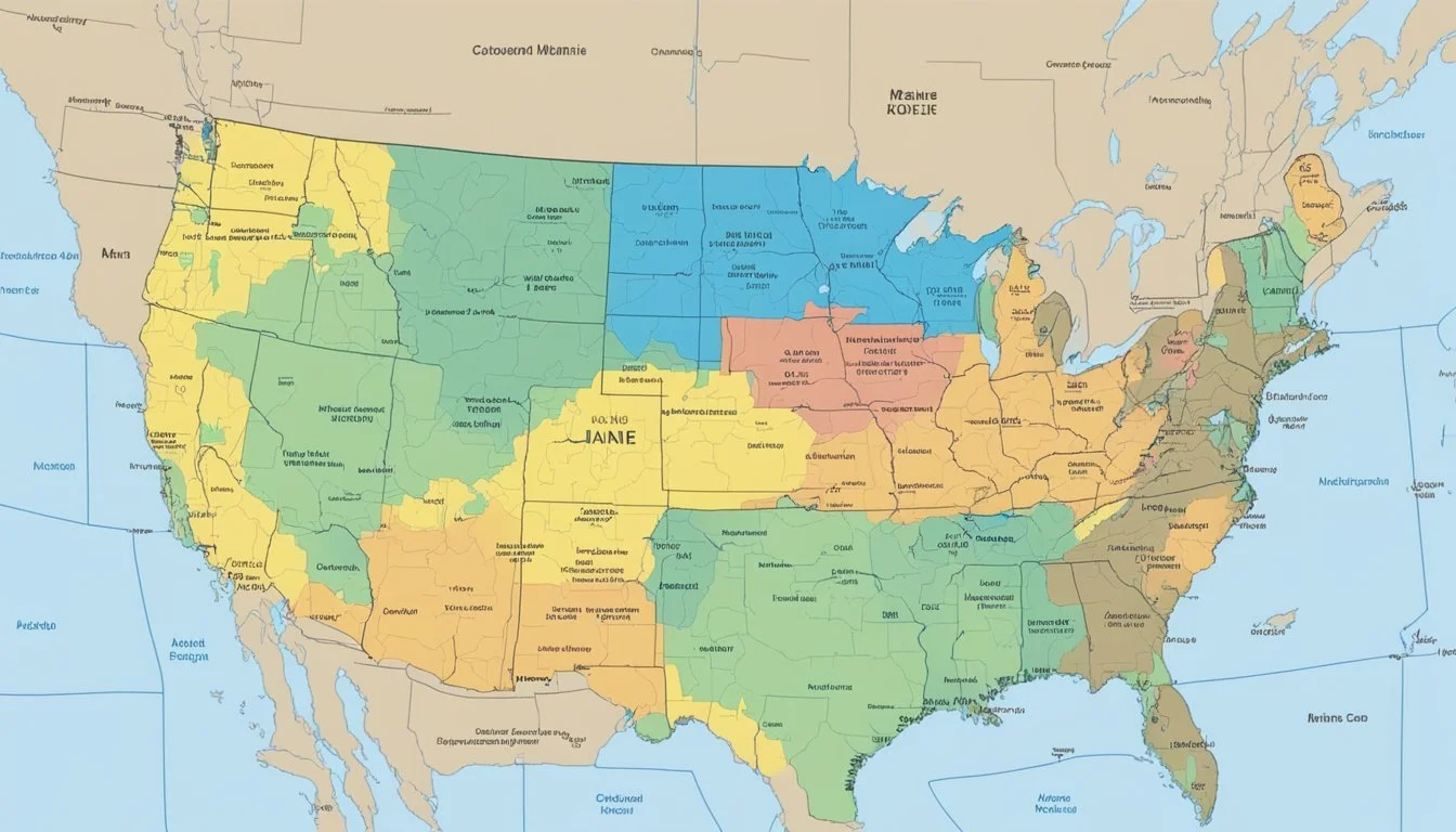
The United States Department of Agriculture (USDA) Plant Hardiness Zone Map is a critical tool for gardeners, landscapers, and agricultural producers, serving as a guideline for determining the suitability of different plants to the climate of a region. In the context of Maine, a state with varied topography ranging from coastal areas to mountainous regions, understanding the local hardiness zones helps residents select the plants that are most likely to thrive in their specific locale.

Maine's diverse climate is reflected in its range of USDA Hardiness Zones, which in the state span from 3b, in the more frigid northern areas, to 5b in some coastal regions. This gradient indicates the average extreme minimum temperatures of each zone, crucial for assessing plant survival during the colder months. The updated 2023 USDA Hardiness Zone Map provides the most recent and accurate data, taking into account weather patterns from the past 30 years to best assist Maine's agricultural and gardening communities.
Gardeners and growers in Maine can utilize this map to fine-tune their planting strategies, ensuring they select species that are suited to withstand the local winter conditions. The tool's precision stems from extensive meteorological data and input from various experts, making it a reliable source for anyone looking to foster a healthy, resilient garden or crop in the Pine Tree State.
Understanding USDA Hardiness Zones
The USDA Hardiness Zones are a valuable tool for gardeners and growers to identify which perennial plants are likely to survive and thrive in a given location, informed by the area's climate patterns and extreme minimum temperatures.
Definition and Purpose
The USDA Plant Hardiness Zone Map serves as a guideline that outlines distinct geographical zones where various categories of plant life are capable of growing, as determined by the average annual extreme minimum temperature. Hardiness zones are integral in helping gardeners understand the most suitable plants for their locale.
Maine's Climate and Hardiness Zones
Maine's diverse climate is captured within several hardiness zones, ranging from the cooler Zone 3b to the relatively milder Zone 5a. Recent weather data reflects how Maine's zones have shifted due to a warming climate, affecting planting strategies across the state.
How Hardiness Zones Are Determined
Hardiness zones are determined by analyzing climate data, particularly focusing on the average annual extreme minimum winter temperature over a 30-year period. The updated USDA map incorporates recommendations from experts, adhering to changes in climate patterns across regions.
Understanding the Zone Numbers and Letters
Each USDA zone is identified by a number and a subsequent letter, with the number denoting a 10-degree F zone. In contrast, the letter—a or b—indicates a 5-degree F half zone. For example, the distinction between Zones 7a and 7b is a mere 5-degree Fahrenheit difference in the average annual extreme minimum temperature.
The USDA Plant Hardiness Zone Map
The USDA Plant Hardiness Zone Map is essential for gardeners and growers to determine which plants are likely to succeed in their region. It offers detailed zones based on the average annual minimum winter temperatures, allowing for informed planting decisions.
Navigating the Map
The USDA Plant Hardiness Zone Map is constructed with clarity in mind. Users can locate their specific hardiness zones by inputting their zip code into the designated search field, which then zooms in on the map and provides the relevant zone information. The map is color-coded, with each color representing different temperature ranges, making it easy to identify one's zone at a glance. The legend on the map ensures that users can expand their understanding of the temperature ranges associated with each zone.
Accessing Map Resources
For those wishing to use the map offline, map downloads are available via the official USDA website. These include high-resolution images and state-specific maps, which are handy for those without consistent online access. Additionally, resources such as detailed descriptions and FAQs help users gain more insight into the plant hardiness map and how it was created.
Utilizing the Map for Maine
In Maine, the USDA Plant Hardiness Zone Map reveals a range of zones due to the state's diverse climate. Gardeners in Maine can utilize this map to identify which perennial plants have the best chance of surviving the harsh winters in their exact location. For instance, coastal areas may fall within a warmer zone, while mountainous regions will be indicated as cooler zones, guiding growers in selecting appropriate species for their environment.
Gardening with Hardiness Zones
Understanding hardiness zones is crucial for gardeners in Maine to select appropriate plants that can withstand the local climate. These zones are defined by the average minimum winter temperatures and play a vital role in determining which plants will thrive.
Selecting Plants for Your Zone
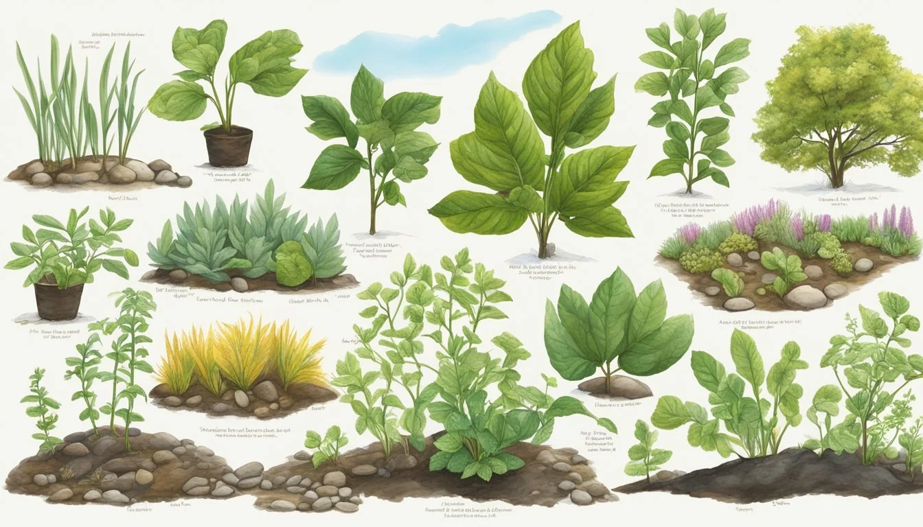
Gardeners should choose plants that are well-suited to their specific USDA hardiness zone. For example, if a gardener lives in a Zone 5a area of Maine, they should select perennial plants that can tolerate winter lows reaching -20°F to -15°F. This careful matching ensures that the plants have the best chance to survive the winter and grow year after year.
Maine's Gardening Season
Maine's growing season can be short, so understanding the local hardiness zones helps extend this period effectively. For instance, plants in Zone 3b need to be able to endure much colder temperatures than those in Zone 5a. Gardeners and growers must consider both the cold hardiness and the length of the growing season influenced by these zones to ensure a successful garden.
Cold Hardiness and Plant Survival
Cold hardiness is essential for plant survival, especially in areas with severe winters like Maine. The hardiness zones guide gardeners on which perennial plants to choose that will best survive the winter temperatures and conditions, such as snow and frost. Certain plants better adapted to cold may even use the snow as insulation, whereas others might require protection when exposed to cold winds and freezing temperatures.
Regional Considerations in Maine
Maine's diverse climates from coastal fronts to interior highlands necessitate a keen understanding of the USDA Hardiness Zones, as these are critical for local gardeners and agricultural professionals.
Coastal vs. Inland Zones
Maine's coastline, influenced by the Atlantic Ocean, generally experiences milder winters compared to the interior, allowing for a different spectrum of plant species that can survive. Coastal zones tend to be in higher Hardiness Zones, indicating less severe winter temperatures, while inland areas can experience much colder conditions, falling into lower Hardiness Zones. For example, coastal cities like Portland and Rockland typically experience warmer winters than towns like Caribou or Presque Isle that are farther inland.
Key Locations and Their Zones
Auburn and Lewiston, sitting in Hardiness Zones 5a and 5b, can sustain different plant life compared to Augusta and Waterville in slightly colder zones. Scarborough and Saco, benefiting from coastal warmth, are usually placed in Zone 5b, unlike Bethel or Lewiston which may be in Zones 4b and 5a respectively. Understanding the specific Hardiness Zone of a locality ensures the correct selection of flora that can thrive in an area.
Adjusting Gardening Practices for Local Conditions
Adaptation to the local environment is crucial for gardening success in Maine. Wind patterns, for example, can impact soil dryness and plant durability. Gardeners in Biddeford must account for the salty ocean breezes, whereas those in Auburn or Bangor need to prepare for more extreme temperature fluctuations between seasons. Winter temperature is a major factor for plant survivability and thus, influences the types of species introduced across communities such as Kennebunk, Gorham, and Falmouth.
By mapping out this detailed localization, residents of Maine can fine-tune their planting strategies and ensure their gardens and crops align with the environmental realities of their specific region.
Impact of Climate Change on Hardiness Zones
Climate change is visibly reshaping plant hardiness zones across the United States, impacting states like Maine with a noticeable warming trend. The United States Department of Agriculture's (USDA) Plant Hardiness Zone Map is an essential tool for gardeners and farmers, offering guidance on which plants are most likely to thrive in a given location.
As temperatures increase, these zones are shifting. Specifically, in Maine, the recent update to the map reflects a warming climate, indicating a transition in hardiness zones that could affect local agriculture and gardening practices. The new zones underscore the effects of a warming climate and offer a practical example of how climate change impacts flora and ecosystems.
Maine's growers now face a half-zone migration northward, signifying warmer average minimum temperatures. This shift has several implications:
Guidance for Planting: Farmers and gardeners must consider the updated zones when choosing plants to ensure compatibility with the altered climate.
Extended Growing Seasons: Certain crops may now have longer growing seasons, potentially increasing yields.
Risk of Invasive Species: Warmer temperatures might invite invasive species better suited to these new conditions, posing a threat to native species and biodiversity.
The hardiness zone adjustment in Maine is a microcosm of broader climate change trends affecting the entire country, calling for adaptive measures in agricultural and horticultural practices.
Government Resources and Updates

The United States Department of Agriculture (USDA) serves as a vital resource for gardeners, farmers, and researchers who are interested in understanding plant hardiness across various regions, including Maine. The USDA's Plant Hardiness Zone Map is an essential tool to determine which perennial plants are more likely to thrive in specific locations. In Maine, these resources are especially important due to the state's diverse climates and growing conditions.
In November 2023, the USDA officially released an updated version of its Plant Hardiness Zone Map. This update was the first of its kind since 2012, reflecting the ongoing commitment to providing the most current data to the agricultural community.
The updated map is informed by a collection of meteorological data from the period of 1991-2020 and incorporates the insight of a panel of experts from multiple disciplines. Mainers can access the updated map via the University of Maine Cooperative Extension or directly through the USDA's dedicated plant hardiness website.
Here are key highlights of the update:
30-Year Weather Data: The map uses three decades of weather data, which gives a more accurate representation of recent climatic shifts.
10-Degree F Zones: Temperature zones are displayed in 10-degree Fahrenheit increments, with subdivisions of 5-degree F half zones, to allow precise regional differentiation.
By maintaining and updating these resources, the USDA provides an indispensable service to the agricultural sector. This ensures that farmers and gardeners in Maine have access to the latest information for strategic planting and cultivation decisions.
Frequently Asked Questions

In order to assist gardeners and landscapers in Maine, this section provides targeted responses to common inquiries about USDA Hardiness Zones within the state. It offers precise information about zone identification and differences, as well as how to locate the most accurate and updated hardiness zone maps.
How do I find the USDA Hardiness Zone for a specific zip code in Maine?
Gardeners can determine the USDA Hardiness Zone for any specific zip code in Maine by using the USDA Plant Hardiness Zone Map. By entering the zip code on the website, one can easily find the precise hardiness zone for their local area.
What is the range of USDA Hardiness Zones found within the state of Maine?
The state of Maine spans a variety of climate conditions and thus includes multiple USDA Hardiness Zones. These range from Zone 3b, with minimum temperatures as low as -35°F, to Zone 5b, which has minimum temperatures down to -15°F, as detailed on the interactive Maine USDA Plant Hardiness Zone Map.
Can you explain the main differences between adjacent USDA Hardiness Zones, such as Zones 5b and 5a?
Adjacent USDA Hardiness Zones, like Zones 5b and 5a, differ by a 5°F increment. Zone 5b has an extreme minimum temperature range of -15°F to -10°F, while Zone 5a ranges from -20°F to -15°F. This temperature difference dictates the survival and growth of different plants within each zone.
Where can I access an accurate USDA Hardiness Zone map for regions across Maine?
An accurate USDA Hardiness Zone map for various regions across Maine can be found through the University of Maine Cooperative Extension website, which offers an interpretation of the hardiness zones based on updated climatic data.
Is there a variation in hardiness zones between coastal and inland areas of Maine?
Yes, there is a noticeable variation in hardiness zones between the coastal and inland areas of Maine. Typically, coastal regions are warmer due to the moderating effect of the ocean, resulting in higher hardiness zones, while inland areas tend to be cooler and have lower zone designations.
Where does Portland, Maine, fall within the USDA Hardiness Zones?
Portland, Maine, is located within USDA Hardiness Zone 5b. This means the area is suited for plants that can withstand minimum temperatures between -15°F and -10°F. Due to Portland's coastal location, it benefits from slightly warmer temperatures compared to more inland parts of Maine.
