
USDA Hardiness Zones in Missouri
Navigating Planting Recommendations
Understanding the USDA Hardiness Zone Map is crucial for gardeners and growers in Missouri, as it provides valuable information on which plants are most likely to thrive in their region. The USDA Hardiness Zones are based on the average annual extreme minimum winter temperatures and are delineated in 10-degree F bands. Gardeners in Missouri benefit from this research-backed guidance to make informed decisions about plant selection and care.
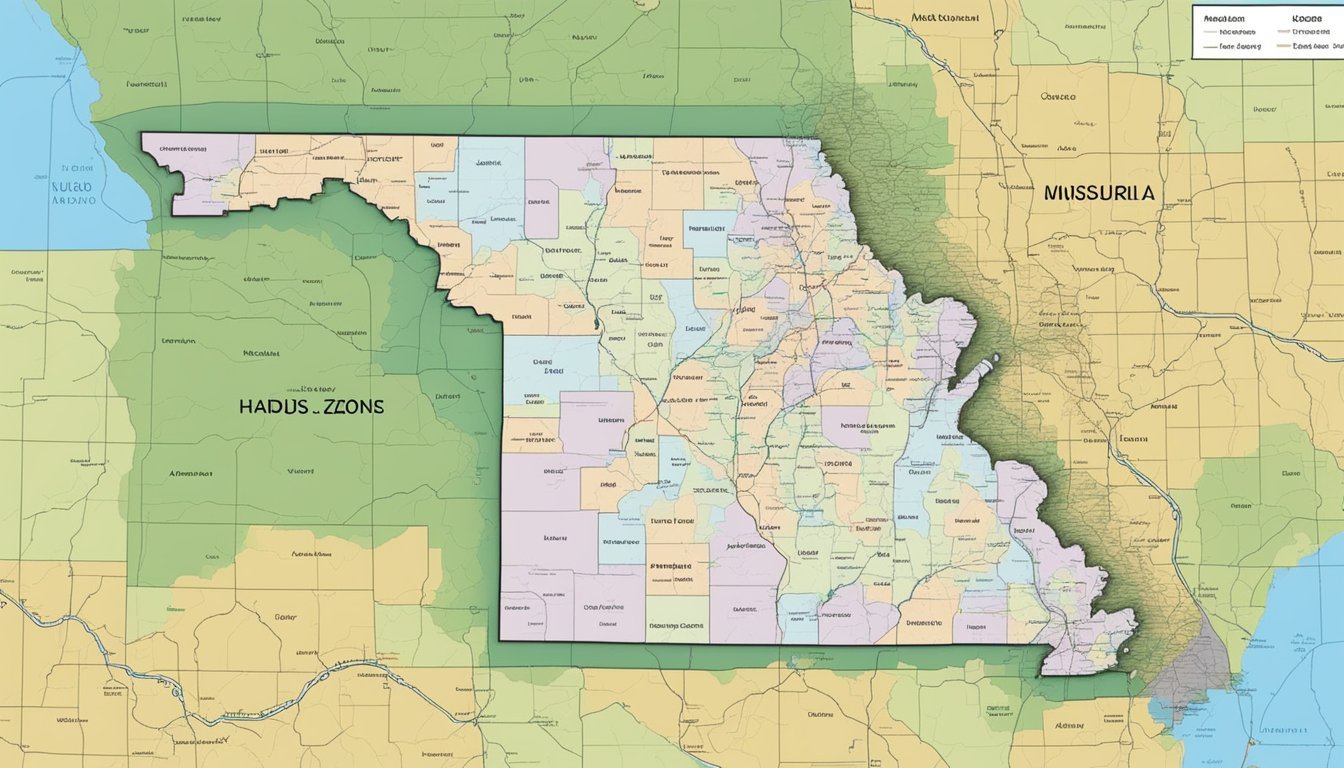
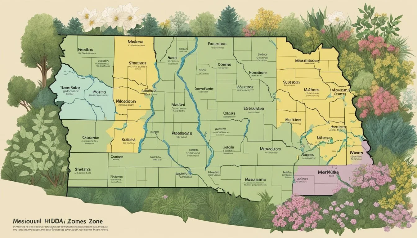
Missouri itself exhibits a range of climate zones that can impact plant survival and growth. The state is divided into several hardiness zones: from 5b in the north, characterized by colder temperatures, through 6a and 6b in the central areas, to 7a and 7b in the south, and even a portion of zone 8a in the southeast corner. These designations assist local gardeners in choosing perennials, shrubs, and trees that are best suited to Missouri's varied climate conditions.
The recent update to the Plant Hardiness Zone Map by the USDA marks an important development in agricultural and horticultural planning. By taking into account the latest climatic data, researchers have provided a more accurate tool for Missouri growers looking to optimize their planting strategies. These zones can affect fruit and vegetable gardens, ornamental plantings, and landscape architecture, making the map a key reference for both amateur and professional horticulturalists across the state.
Understanding USDA Hardiness Zones
The USDA Hardiness Zones are a crucial tool for gardeners and growers in Missouri, providing guidance on the most suitable plants for a specific location based on climate data.
Zone Definitions
The USDA Plant Hardiness Zone system classifies regions across the United States by the average annual extreme minimum temperature. Each zone represents a range of this minimum temperature, essential for plant survival. Missouri features multiple zones, reflecting its climatic diversity. For instance, Zone 5b indicates temperatures ranging from -15°F to -10°F, while Zone 6a encompasses ranges from -10°F to -5°F.
Zone Map Overview
Missouri's USDA zone map is an interactive guide that details where each hardiness zone is located within the state. These geographic delineations are based on temperature data and are crucial for understanding the climate at different locations within Missouri. Such maps are invaluable assets for those who need to determine the viability of specific plants in their local area. Gardeners and agricultural planners consistently refer to the up-to-date zone map to inform their planting strategies.
Missouri's Climate and Hardiness Zones
Missouri's diverse climate significantly impacts the hardiness zones within the state, affecting plant growth and sustainability. This section explores how climate factors influence these zones and the variations observed across the Missouri region.
Climate Influences
Missouri experiences a climate that is largely continental with cold winters and hot, humid summers. Temperature extremes fluctuate between the northern and southern parts of the state, influencing the hardiness zones assigned by the USDA. These designations help gardeners and growers understand which plants are most likely to thrive in their area. Critical weather patterns, such as the frequency of cold snaps and the length of the frost-free season, are factored into localized hardiness zone data.
Zonal Variations Across the State
The state of Missouri is classified into multiple planting zones. In the northern regions, Zone 5b is prevalent, where minimum temperatures can range between -15°F to -10°F. Central Missouri typically falls within Zones 6a and 6b, with winter lows averaging between -10°F to 0°F. Moving southward, Zones 7a and 7b experience milder winters with minimum temperatures ranging from 0°F to 10°F. The USDA Hardiness Zone Map provides an authoritative guide for determining which plants are most appropriate for cultivation based on these climate-related hardiness zones.
Notably, Missouri's climate and resultant hardiness zones are crucial for U.S. agriculture, guiding the planting decisions for a variety of crops suited to Missouri's temperature conditions.
Navigating the USDA Plant Hardiness Zone Map
When gardening in Missouri, understanding the USDA Plant Hardiness Zone Map is essential. This detailed graphic resource helps gardeners pinpoint which plants are most likely to thrive in their area.
How to Read the Map
The USDA Plant Hardiness Zone Map divides North America into areas based on average annual extreme minimum temperatures. Each zone is marked by a 10-degree Fahrenheit range and further categorized into "a" (the colder half) and "b" (the warmer half). Gardeners can observe the various shaded regions on the map to determine the specific zone they live in. Missouri, for example, spans multiple hardiness zones, which impacts local planting strategies.
Finding Your Zone
To find a specific hardiness zone, gardeners can simply input their zip code into the search feature on the USDA's map webpage. This will immediately bring up the precise plant hardiness zone for their location. In Missouri, where zones can vary significantly, this tool is particularly useful for both novice and experienced gardeners, ensuring they can select plants suited to their local climate conditions as outlined on the USDA hardiness zone map.
Application for Gardening and Agriculture

Understanding the USDA Hardiness Zones in Missouri is crucial for both gardeners and agricultural professionals. The zones inform which perennial plants are most suitable for the state's varying climate conditions.
Gardening Tips
Gardeners in Missouri can consult the 2023 USDA Plant Hardiness Zone Map to determine the most appropriate perennials for their gardens. Depending on the zone:
Zone 5b: It is advisable to choose plants that can endure temps as low as -15°F.
Suitable perennials: Peonies and hostas
Ideal shrubs: Boxwood and hydrangeas
Zone 6a & 6b: These zones experience minimum winter temperatures ranging from -10°F to 0°F.
Hardy flowers: Daylilies and coneflowers thrive here.
Vegetable gardens: Consider planting in spring to get a head start before the summer heat.
Agricultural Planning
Agriculture professionals use the USDA Hardiness Zone Map for strategic crop selection and seasonal planning.
Fall Planting: Growers in warmer parts such as Zone 7a must select crops that can establish before winter begins.
For instance, planting winter wheat in fall is optimal for growth and yield.
Perennial Crops: It's crucial to assess the compatibility of crops like berries or fruit trees with the specific hardiness zone, ensuring their survival and productivity through cold months.
Keeping abreast with zones helps gardeners and those in agriculture anticipate seasonal changes and protect plants from extreme temperatures, leading to successful cultivation.
USDA Zone Updates and Changes
The latest USDA Plant Hardiness Zone Map reflects significant updates to the zones in Missouri due to temperature trends and climate change impacts. This section outlines the specific changes and the effects of global climate patterns on these updates.
Update History
The U.S. Department of Agriculture (USDA) periodically updates the Plant Hardiness Zone Map to reflect changes in average temperatures. Since the inception of the map, revisions have been made as new data becomes available. The most recent update, drawing on data from 1991 to 2020, was released in November 2023. It provides a detailed look at how warming trends have altered the growing conditions across Missouri. The USDA unveils updated Plant Hardiness Zone Map, a resource that is indispensable for gardeners and agricultural professionals alike, showcasing the adaptation of plant zones to the evolving climate.
Climate Change Impact
Global climate change and its associated warming have been key drivers in the changing hardiness zones. The Agricultural Research Service, a division of the USDA, has observed a noticeable shift towards warmer zones. This means many areas in Missouri that were previously categorized in cooler zones have now transitioned to warmer zones. The overall average temperatures have increased, influencing not only planting decisions but also the selection of plant varieties that can thrive in Missouri's evolving climate. The recent map places most of Missouri in zone 6, indicating an average winter low temperature from 0 to -10 degrees Fahrenheit. These trends underscore the reality of climate change and its tangible effects on agriculture and gardening.
Advancements in Zone Mapping
Recent enhancements in zone mapping for plant hardiness have leveraged detailed data collection and sophisticated mapping methods to provide more precise guidance for Missouri gardeners and researchers.
Data Collection
The introduction of a higher density of weather stations has significantly improved data accuracy for the USDA Hardiness Zone Map. With the integration of information from over 13,412 stations, an increase from 7,983 for the 2012 map, the data layer accommodates a more granular view of climatic variations across Missouri. This enhanced data collection strategy ensures that the hardiness zones reflect more accurate indicators of local climate conditions, which are imperative for planning and planting.
Mapping Methods
Mapping methods have advanced through the use of PRISM technology, which considers both geographic features and weather data to define zones. This agency-led upgrade offers a more detailed and accurate map by utilizing 30-year averages of climate patterns. The designations are now provided with a precision that aligns closely with the distinct climatic conditions found throughout Missouri. The resulting zones are presented online, allowing for easy access and use as a research tool or a guide for plant selection according to hardiness zones.
Factors Affecting Plant Survival
When considering plant survival in Missouri, it's essential to account for the local climate variables and environmental conditions. Plants' viability is closely linked to their ability to withstand average annual extreme minimum temperatures and sudden temperature changes such as extreme cold snaps.
Temperature Extremes
Missouri's plant hardiness zones are affected significantly by average annual extreme minimum temperatures. These temperatures, which represent the coldest point a region reaches, are critical in determining whether a plant will survive. They are split into different planting zones, reflecting ranges of temperatures, such as those delineated by the USDA Issues Revised Plant Hardiness Zone Map. An extreme cold snap can cause damage or death to plants not suited for a specific zone.
Other Influential Factors
Beyond temperature, several other factors contribute to plant hardiness and survival:
Wind: Strong winds can exacerbate the chill of cold temperatures, increasing the risk of frost damage.
Soil Type: Whether soil drains well or retains moisture can affect root health during temperature extremes.
Humidity: Affects transpiration rates and can either mitigate or intensify temperature stress on plants.
Winter Sunshine: The amount of sunlight during the colder months can impact a plant's rest period and energy reserves.
Microclimates: Local variations, such as those found in urban settings or valleys, can create pockets where temperature and humidity vary significantly from the surrounding area.
These elements, collectively with hardiness zones, define the survival resolutions for gardeners and agriculturalists in all territories of Missouri.
Frequently Asked Questions
Understanding USDA Hardiness Zones is essential for gardening and agriculture in Missouri. These FAQs will help clarify suitable plants for various zones, recent changes, and specifics on regions like St. Louis.
How can I find out which plants are suitable for my area's hardiness zone in Missouri?
Gardeners can visit the Missouri Interactive USDA Plant Hardiness Zone Map to identify plants appropriate for their local climate.
Where can I locate a planting zone map specific to Missouri?
The specialized USDA Plant Hardiness Zone Map offers detailed information about the various planting zones across Missouri.
How can I determine the planting zone for my specific zipcode in Missouri?
For a precise planting zone by zipcode, individuals can utilize the USDA's Plant Hardiness Zone Map search feature.
Has Missouri's hardiness zones changed recently and where can I find the latest information?
Recent shifts in hardiness zones have been documented, reflecting changes in climate patterns. To find the most current information, visit USDA Issues Revised Plant Hardiness Zone Map.
What hardiness zone does St. Louis, Missouri, fall under?
St. Louis, Missouri, is characterized by zone 6, allowing gardeners to select plants commensurate with this classification.
Can you provide a list of plants ideal for Missouri's climate and hardiness zones?
Although a comprehensive list is beyond the scope of this FAQ, resources like the Missouri Planting Zones - USDA Map can guide gardeners toward selecting region-appropriate vegetation.
