
USDA Hardiness Zones in Wisconsin
A Guide to Planting Success

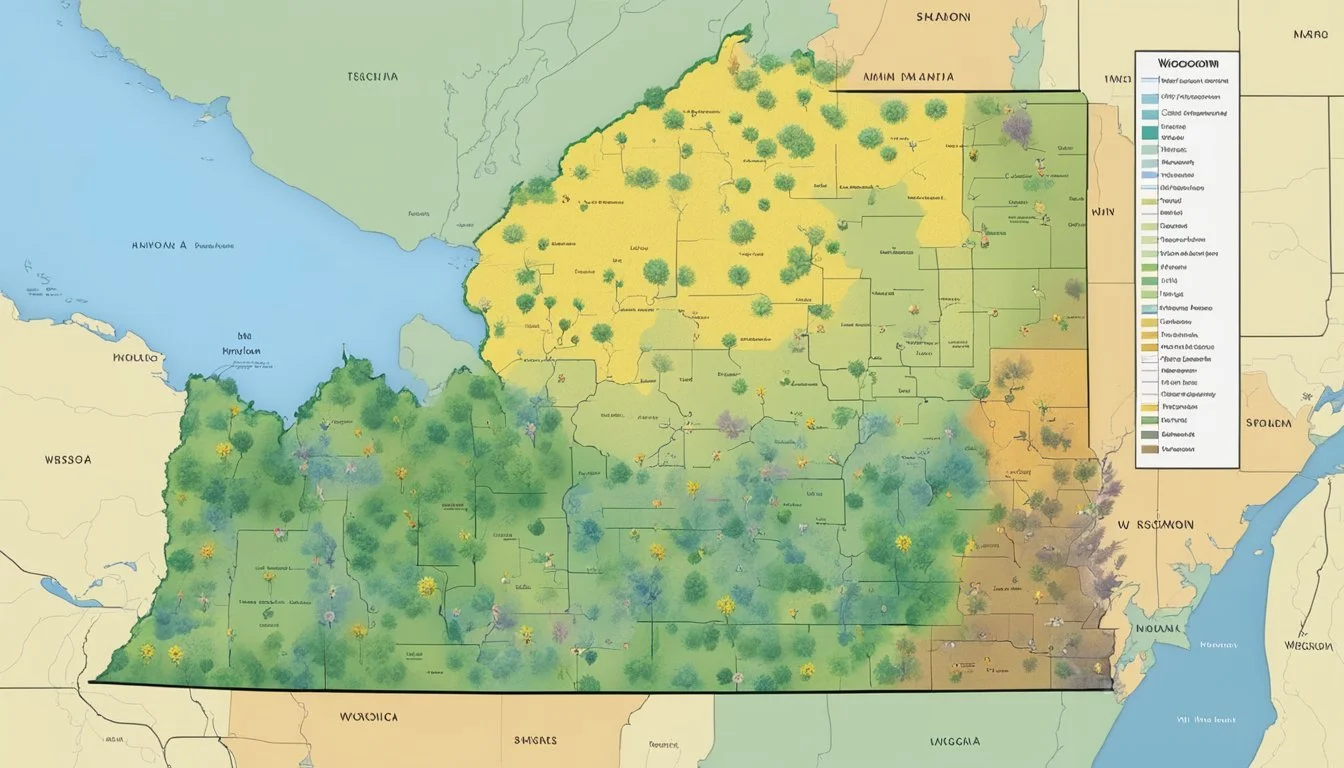
Understanding the USDA Hardiness Zones is crucial for gardeners and agricultural professionals when selecting plants for landscaping and crop production. These zones are defined by the USDA and determine the different areas in the United States where various types of plants are most likely to thrive, based on climate and temperature ranges. For the state of Wisconsin, these hardiness zones are particularly important due to its varied climate, with temperatures that can reach extremes during the winter months.
Wisconsin is characterized by a range of hardiness zones, indicative of the state's diverse weather patterns. Gardeners and growers rely on this information to make informed decisions about what will grow successfully in their gardens or on their farmland. The zones not only guide planting times but also inform the selection of species that can tolerate the local minimum temperatures. With the ever-changing climate, the USDA periodically updates the hardiness zone map to reflect current environmental conditions, ensuring that plant selection guidance remains relevant.
Understanding USDA Hardiness Zones

The concept of USDA Hardiness Zones is essential for gardeners and agriculturists to grasp, serving as a guide for determining the most suitable plants for a certain location based on climate.
Definition of Plant Hardiness Zones
Plant Hardiness Zones are geographically defined areas illustrated on a map that assist gardeners in identifying how well plants will withstand local winter temperatures. The USDA Plant Hardiness Zone Map designates these zones by the average annual extreme minimum temperature over a 30-year period. Each zone represents a range of this minimum temperature, typically in 10-degree Fahrenheit increments, with the map further refined into 5-degree Fahrenheit half zones.
For example, in the context of Wisconsin, which spans several zones, understanding that a specific location falls within Zone 3b as opposed to Zone 6a can directly influence the success of perennial plantings. Gardeners use this information to ascertain which plants have the best chance to thrive year after year in their gardens.
Frequently Asked Questions
This section addresses common inquiries regarding the USDA Hardiness Zones in Wisconsin, providing readers with specific information on how to find and understand planting zones across the state.
How can I find my specific planting zone by zip code in Wisconsin?
One can find their specific planting zone in Wisconsin by entering their zip code into the search tool available on the USDA Plant Hardiness Zone Map.
Where can I find an updated map of Wisconsin's USDA hardiness zones?
An updated map reflecting the most recent changes in Wisconsin's USDA hardiness zones can be viewed on the Wisconsin Horticulture website.
Is there a resource where I can access the Wisconsin USDA hardiness zones in PDF format?
Yes, a downloadable PDF of the new USDA Cold Hardiness Zone Map can be found on the Wisconsin Horticulture page.
What are the most recent changes to USDA hardiness zones in Wisconsin?
Recently, Wisconsin has seen the addition of a warmer zone 6a, representing a shift in some areas due to changes in climate, which can be further explored through resources like Wisconsin Public Radio.
Which planting zone does Appleton, Wisconsin, fall under?
Appleton, Wisconsin, is in the USDA hardiness zone 5b, as shown through interactive tools and maps provided by platforms like Plantmaps.
How can I determine the correct planting zone for La Crosse, Wisconsin?
For the correct planting zone for La Crosse, Wisconsin, the USDA Plant Hardiness Zone Map offers a searchable database to provide accurate information.
