
USDA Hardiness Zones in Washington
A Guide to Planting Success

Understanding the USDA Hardiness Zones is crucial for gardeners in Washington, as it guides them in selecting the most appropriate plants for their gardens. The USDA Plant Hardiness Zone Map serves as a vital tool in this regard, establishing zones based on the average annual extreme minimum winter temperatures. The zones, delineated in 10-degree F increments, help in determining the climatic conditions a plant is most likely to withstand in specific regions. The recently updated version of the map further refines these distinctions, taking into account the latest climate data, which assists in making more informed planting decisions.
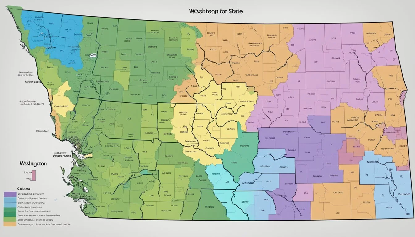
In Washington, the variety of climates from coastal regions to mountainous areas is reflected in the Plant Hardiness Zone Map. The updated planting zones range across the state, indicating suitability for different types of vegetation, from hardy conifers to delicate perennials. Gardeners can utilize this resource to choose plants with the highest chances of thriving in their local environment, increasing the likelihood of gardening success and landscape beauty.
The Washington Interactive USDA Plant Hardiness Zone Map specifically adapts the USDA's findings to the state's unique topographical features. This tool is ideal for anyone seeking a more localized understanding of plants compatible with their area. By providing clear and accurate hardiness zones, the map is invaluable to Washington's agricultural planners, horticulturists, and hobby gardeners alike, ensuring that the plant selections they make are well suited to their environment.
Understanding the USDA Plant Hardiness Zone Map
The USDA Plant Hardiness Zone Map is an essential tool for gardeners, landscapers, and agricultural planners. It provides a geographically-based indicator of where various perennial plants are most likely to thrive.
History and Development
The USDA Hardiness Zone Map was initially created in 1960 and has undergone several updates, the most comprehensive being between 1991 to 2020. These revisions reflect climatic changes and incorporate more sophisticated meteorological data analysis. The U.S. Department of Agriculture's Agricultural Research Service (ARS) has been instrumental in developing these updates. The most recent version employs an interactive GIS-based map, making it more user-friendly and accurate.
Importance for Gardeners and Growers
Gardeners and growers rely on this map to decide which plants are suitable for their local climate. Each hardiness zone is defined by the average annual extreme minimum winter temperature. This information is central to successful gardening and agricultural planning because it informs decisions about which plants are best for a given location. By consulting the USDA Plant Hardiness Zone Map, one ensures that selected plants are compatible with the winter climatic conditions of their region.
Identifying Washington's Zones
Understanding the USDA Hardiness Zones for Washington is essential for gardeners and growers. These zones are determined by the minimum temperatures a location experiences and have a significant impact on plant viability.
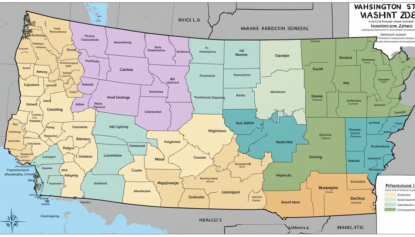
State Map Overview
The Washington Interactive USDA Plant Hardiness Zone Map provides an essential resource for determining the correct zone for your location. The map illustrates variations across the state, reflecting the diversity of climates within Washington.
Zone Distribution and Variations
Washington's zones range from 4b to 9a. Zone 4b indicates an extreme minimum temperature of -25°F to -20°F, while Zone 9a reflects a milder range, with temperatures only dropping to 20°F to 25°F. The state experiences a wide array of microclimates due to its varied topography and coastal influence, leading to localized variations within these broader zones. It's essential for gardeners to consider their specific location—coastal, mountainous, or inland—to choose plants suitable for their plant hardiness zone.
Climate Factors Affecting Hardiness Zones
In Washington, the USDA Hardiness Zones are greatly influenced by several climatic variables, especially temperature factors, which are pivotal in determining the suitability of perennial plants in a given area.
Temperature Influence
Temperature plays a critical role in shaping the USDA Hardiness Zones. Fluctuations in average yearly temperatures, including both the highs and lows, directly impact the zones by shifting the boundaries that define the regions suitable for various plants.
Extreme Minimum Winter Temperature
The extreme minimum winter temperature is a key factor used by the USDA to update the Plant Hardiness Zone Map. This measurement is based on the lowest temperatures recorded by weather stations over a substantial period, establishing the zones by 10-degree Fahrenheit bands and refining them further into 5-degree half zones.
Local Microclimates
Microclimates within Washington can diverge significantly from broader zoning because of local geographic features that influence humidity and temperature. For instance, a garden nestled in a valley may have milder winter temperatures compared to an exposed hilltop location, leading to different plant hardiness conditions even within close proximity.
Using the Zone Information

Determining the right plants for a garden or yard hinges on understanding the local climate. The USDA Plant Hardiness Zone Map is the principal guide for assessing which perennial plants have the best chance of thriving in a specific location.
Selecting Appropriate Plants
When choosing plants, gardeners should prioritize species that are best suited to their zone's average annual extreme minimum temperature. This helps to ensure perennial plant survival through the coldest part of the year. For instance, a plant rated for Zone 5 may not survive the winter if planted in Zone 4 without special care or microclimate adjustments. The 2023 USDA Plant Hardiness Zone Map offers a precise way to align plant selection with local conditions.
Planning a Garden or Yard
Tailoring a garden's layout can also be influenced by understanding zone information. Early planning should involve:
Listing compatible plants: Match flowers, shrubs, and trees with the hardiness zone.
Observing microclimates: Areas within a yard may be warmer or cooler, affecting plant survival.
Considering sun and shade: Factor in the daily and seasonal variations in light.
A well-planned garden harmonizes with the zone's characteristics, ensuring that the architecture of a yard enhances plant health and longevity. Reference to the USDA's interactive tools, such as the zip code zone finder, can further assist in planning a thriving garden.
Additional Considerations for Washington Gardeners
Washington gardeners typically rely on the USDA Plant Hardiness Zone Map to determine the best plants for their gardens. However, understanding the local soil types and weather patterns is equally critical for cultivating a successful garden.
Soil Type and Plant Selection
Soil type in Washington varies greatly from the coastal areas to the interior regions of the state. Coastal areas frequently have sandy loam soils that drain well but may require additional nutrients for optimal plant growth. In contrast, the central and eastern parts of Washington tend to have more clay-like soils, which retain water and nutrients differently. Gardeners should have their soil tested at local weather stations or extension offices to understand its specific properties, including humidity levels, which can influence plant health and soil moisture levels.
Recommended Actions:
Conduct soil testing to understand pH level and nutrient composition.
Choose plants suited for the soil type in your specific region.
Amend the soil as needed to optimize conditions for plant growth.
Considering Annuals and Perennials
When selecting plants, Washington gardeners should consider the longevity and lifecycle of their choices, understanding how annuals and perennials will behave in their Hardiness Zone. Annuals are temporary but can provide vivid color; they might need to be replanted each year, offering flexibility and variety. Perennials, on the other hand, require a more significant initial effort but will return yearly if they are suited to the local climate and soil conditions.
Key Considerations:
Choose annuals for variety and perennials for longevity in accordance with your Hardiness Zone.
Assess how the specific microclimate of your garden affects the survival of annuals and perennials, considering factors like sun exposure and wind patterns.
Accessing and Understanding the Map
Accessing the USDA Plant Hardiness Zone Map is straightforward, and interpreting it correctly is key to successful gardening in Washington. A reliable broadband internet connection aids in the smooth navigation and loading of the map's rich interactive features.
Navigating the USDA Website
To locate the interactive USDA Plant Hardiness Zone Map, one should start by visiting the USDA's official website. Here, users can input their zip code in the provided search field for a quick view of their specific local zone information. The website's interface is user-friendly, offering a variety of tools to zoom in or out of the map and explore different regions with ease.
Reading the Map Details
Understanding the map's details involves recognizing the color-coded Fahrenheit zones. Each color represents a 10-degree Fahrenheit range, indicating the average annual extreme minimum temperatures for that area. Additionally, the map utilizes 5-degree Fahrenheit half zones to provide more precise data. Gardeners should look for plants labeled for their specific zone or a colder zone to ensure they select species adequately resilient to local winter conditions.
Zones Beyond Washington
In understanding the USDA Hardiness Zones, it is essential to recognize how Washington's planting zones compare to those in other states and territories, including Alaska, Hawaii, neighboring states, as well as territories such as Puerto Rico.
Comparison with Neighboring States
Washington's diverse climate offers a range of hardiness zones, typically ranging from 4b to 9a. In contrast, Oregon, directly to the south, shares similar climate variations but extends to zone 8b, indicating slightly milder winter temperatures in some regions. To the east, the state of Idaho varies from zones 3a to 7b, which demonstrates colder winters especially in the more mountainous areas.
Hardiness Zones in Alaska and Hawaii
Alaska, far to the north, experiences much colder climates with hardiness zones ranging from 1a to 8b, with the majority of populated areas falling between zones 2b and 7a. In stark contrast, Hawaii enjoys a tropical climate, with hardiness zones spanning 9 to 13a, indicating no frost and milder temperatures year-round.
Territories and Puerto Rico
The U.S. territories are diverse in their climatic conditions. In Puerto Rico, tropical warmth ensures a relatively narrow range of zones, from 11a to 13a, reflecting the warm, stable temperatures typical of Caribbean islands. Thus, the presented hardiness zones across various regions, from Maine's chilly 3b up to 6a zones to Oregon's mild 8b climates, showcase the vast diversity of growing conditions within the United States and its territories.
Implications for Commercial Growers
Commercial growers in Washington must navigate the implications of updated hardiness zones, as these directly impact decisions on nursery stock and agricultural practices.
Nursery Stock and Hardiness Ratings
The availability and selection of nursery stock now align closely with the revised hardiness zones. Nurseries are navigating these changes by adjusting their stock to account for the shifts in climate. For instance, a Washington nursery that once sold large quantities of Zone 6a plants may now need to adapt its inventory to include more Zone 6b plants in response to the updated USDA Hardiness Zone Map. This adaptation protects growers from investing in stock ill-suited to the evolving average minimum temperatures.
Agricultural Practices and Zone Adaptation
They must adjust their agricultural practices in light of the new hardiness zone information. Careful observation of local climate data, potentially utilizing their on-site weather stations, is critical for understanding micro-climates that can affect crop viability. This focused data collection helps ensure that growers choose crops and varieties that will thrive in the specific conditions of their growing zone. With the updated plant hardiness zone map, growers may find opportunities to cultivate crops previously considered marginal or at-risk, while also remaining vigilant about the risk of colder snaps that can still occur.
Frequently Asked Questions
Understanding the USDA Hardiness Zones is crucial for successful gardening in Washington State. These zones guide gardeners in selecting the most viable plants for their specific location.
How do you determine the USDA Hardiness Zone for a specific location in Washington State?
One can determine the USDA Hardiness Zone for a location in Washington by consulting the 2023 USDA Plant Hardiness Zone Map. The map divides regions based on the average annual extreme minimum winter temperature.
Can you categorize the different climate zones within Washington State for gardening purposes?
Washington State's climate zones range from the coastal region's temperate climate to the central and eastern areas that experience much colder winters. These can be categorized further into several hardiness zones, each with its unique temperature range suitable for different types of perennial plants.
What resources are available for finding plant species that thrive in Washington's USDA zones?
Resources such as the Elisabeth C. Miller Library's USDA Hardiness Zone Map provide insights into plant species that are adapted to Washington's diverse USDA Hardiness Zones.
How does the USDA Hardiness Zone system apply to landscaping in the Pacific Northwest region?
The USDA Hardiness Zone system assists landscapers in the Pacific Northwest by identifying which plants are most likely to withstand the region's winter temperatures, ensuring the selection of suitable plants for sustainable landscapes.
Where can I find a detailed map of USDA Hardiness Zones specific to Washington State?
A detailed map that showcases Washington State's specific USDA Hardiness Zones is available on Plantmaps, focusing on the varying climate conditions across the state.
What are the implications of Washington's Hardiness Zones for seasonal planting schedules?
Washington's Hardiness Zones inform gardeners about the optimal time for planting and the likelihood of a plant's survival and productivity during the state's varying seasonal conditions.
