
USDA Hardiness Zones in Kansas
A Guide to Optimal Planting
Understanding the USDA Hardiness Zones is crucial for gardeners and farmers in Kansas to ensure the successful growth of their plants. The USDA Plant Hardiness Zone Map serves as a valuable reference that delineates areas based on their average annual extreme minimum winter temperatures. These zones, marked by 10-degree Fahrenheit increments and further divided into 5-degree half zones, are essential for making informed decisions about which perennial plants are most likely to thrive in a particular location.

Recent updates to the hardiness zone map reflect changes in climate patterns, providing more granularity with new weather station data and an improved algorithm. In Kansas, the shifts in zones have been noted, with much of the state experiencing a half-zone increase in average warmth. This has resulted in parts of southern Kansas now falling into a warmer Zone 7, expanding the variety of plants that can potentially be cultivated in these regions.
The updated map is designed to be interactive and internet-based, offering tools that allow users to search by zip code. This level of detail ensures that gardeners and growers are working with the most current and specific information to guide their planting decisions, a testament to the map’s ongoing evolution and relevance in the agricultural and horticultural communities of Kansas.
USDA Hardiness Zones Overview
The USDA Plant Hardiness Zone Map is an essential guide for gardeners and growers to determine the likelihood of plant survival and growth in different regions. This section delves into the zones' relevance, their development by the USDA, and their significance in agricultural and gardening applications.
Understanding Hardiness Zones
Hardiness zones are geographic areas defined by a range of climatic conditions relevant to plant growth and survival. The USDA Plant Hardiness Zone Map divides North America into 13 primary zones based on the average annual extreme minimum temperature. Each zone is delineated by a 10°F temperature difference, further divided into 5°F subzones labeled "a" and "b."
Role of USDA in Hardiness Zoning
The USDA is responsible for creating and updating the hardiness zone map, which is a vital tool for helping predict a plant's likelihood to thrive at a location. The map's creation involves comprehensive data analysis, including climate statistics, which the USDA updates periodically to reflect changes, such as those recorded in the latest 2023 revision.
Importance for Gardeners and Growers
Gardeners and growers rely heavily on hardiness zones for successful plant selection and cultivation. For instance, knowing the zone for Kansas enables them to ascertain which plants will survive local winter temperatures. A deep understanding of these zones also supports gardeners in making informed choices about when to plant. The Kansas Hardiness Zone Map depicts the hardiness levels throughout the state, impacting planting strategies extensively.
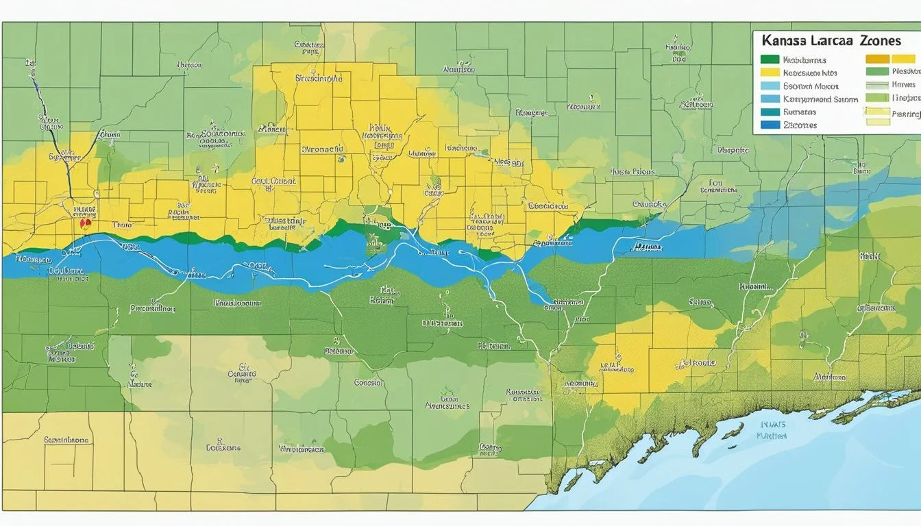
Hardiness Zones of Kansas
The USDA Hardiness Zones in Kansas span from Zone 5 to Zone 7, reflecting the state's varied climate conditions. Kansas gardeners rely on these zones to determine the types of plants that can thrive within the state's diverse landscapes, which include both temperate and sub-humid regions, as well as the presence of regional microclimates.
Zonal Distribution in Kansas
In Kansas, the hardiness zones are geographically specific. They delineate areas based on the average annual minimum winter temperature. Zone 5, which can experience temperatures as low as -20°F, is most common in the northern parts of the state. This zone can extend down the middle, capturing the variability of Kansas's climate.
On the other hand, Zone 7 is typically found in the southernmost areas, characterized by milder winters, with minimal temperatures rarely dropping below 0°F. This delineation is crucial for growers and gardeners to understand which plants are likely to survive the winter, and how they can best plan their gardens.
Adapting to the Kansas Climate
Gardeners in Kansas often have to account for microclimates—small areas where the climate varies from the surrounding area. Structures, bodies of water, or elevation changes can create these microclimates, affecting how plants grow. Especially in urban areas or valleys, microclimates can cause a location to fit into a different hardiness zone than the broader regional classification.
To adapt, it's essential for one to observe the local conditions keenly and choose plant species and varieties accordingly. Understanding Kansas's hardiness zones is just the beginning; a successful gardener also pays close attention to the unique microclimates within their immediate environment.
Interpreting the Plant Hardiness Zone Map
The USDA Plant Hardiness Zone Map provides crucial data to guide gardeners and farmers in selecting plants that are likely to thrive in their specific regions of Kansas. Utilizing information on extreme minimum temperatures from various data sources, this tool is pivotal for successful plant growth and sustainability.
Map Details and Data Sources
The USDA Plant Hardiness Zone Map uses temperature data accumulated from a wide range of weather stations to delineate distinct zones. Each zone represents an area of 10-degree Fahrenheit bands based on the average annual extreme minimum temperature. The map's data is both historical and contemporary, reflecting climatic patterns to assist in informed garden planning and agricultural decision-making.
Interactive Map Features
Accessing the interactive version of the Plant Hardness Zone Map allows gardeners and farmers to click on a specific region to reveal its hardiness zone accurately. This interactive tool is invaluable as it provides a more granular view complete with half-zone increments (e.g., 5a or 5b), ensuring greater precision for users in Kansas. These features can be found on websites such as Plantmaps which detail hardiness zones for cities across the state.
Using the Map for Gardening and Agriculture
For those engaged in gardening or agriculture, understanding how to use the map can mean the difference between a thriving crop and a failed one. Plant selection should be aligned with the zone's minimum temperatures to ensure plant survival during winter months. Armed with insight from the map, one can select plants suited for each temperature zone, which is particularly important for perennials expected to withstand Kansas's diverse climates. The USDA map is also used in research models and setting crop insurance standards, showcasing its practical relevance in the agricultural sector, as mentioned on the USDA ARS website.
Climatic Factors Affecting Plant Growth
The successful cultivation of plants in Kansas hinges on understanding the climatic factors that influence growth, which encompass temperature, light, humidity, and soil conditions.
Temperature Influences
Temperature is a primary climatic factor that affects plant hardiness and growth. The USDA Plant Hardiness Zone Map classifies regions based on their average annual extreme minimum temperatures to guide gardeners and growers. Kansas, for example, sees a range of hardiness zones, indicating varying plant survival thresholds due to temperature differences across the state. In particular, extreme winter lows play a critical role in what perennials can thrive or survive in an area.
Light, Humidity, and Soil Conditions
Apart from temperature, light and humidity are also significant for plant development. Adequate sunlight drives photosynthesis, which is critical for plant energy production. Conversely, humidity influences plant transpiration rates and moisture uptake. The Shifts in Growing Degree Days, Plant Hardiness Zones reflect the critical importance of these factors alongside temperature.
Soil conditions in Kansas can vary, impacting plant health and growth. Soil quality, pH, and the presence of organic matter determine nutrient availability and water retention capabilities. With changing climate conditions, warmer hardiness growing zones are shifting, and with them, the soil dynamics. It is important for growers to adapt their practices accordingly, taking into account these evolving elements for optimal plant growth.
Scientific Research and Updates

In updating the USDA Plant Hardiness Zone Map, significant research was undertaken for the first time in over a decade. Scientists used the latest data to create a map that reflects plant survivability and growth data over the past 30 years.
Data Collection and Analysis
The foundation of the 2023 map relies on extensive data collection and meticulous analysis. Researchers gathered temperature records from numerous weather stations over a 30-year period and used advanced algorithms to interpolate this data, thus ensuring a high level of accuracy in depicting the hardiness zones. The updated map accounts for variations in microclimates, including those influenced by urban development.
Future Projections and Adjustments
Ongoing adjustments to the map are an imperative part of the USDA's research efforts. Scientists consider current climate trends to make future projections, ensuring that the map remains a relevant tool for growers and gardeners. The 2023 map reflects comprehensive updates, providing an essential guide for understanding how plant hardiness zones may shift over time, influencing agricultural practices and ecosystem management.
Practical Applications for Local Growers
This section provides key insights into how Kansas gardeners and growers can leverage the USDA Plant Hardiness Zone Map for optimizing agricultural productivity and ensuring effective risk management.
Agricultural Planning and Risk Management
The USDA Plant Hardiness Zone Map serves as a crucial tool for agriculture planning. It enables Kansas farmers to align their crop schedules with the zones' temperature profiles, thereby reducing the potential for plant loss due to climatic extremes. Closely tied to these planning choices are crop insurance standards. By adhering to the guidance provided by the USDA map, farmers align themselves more closely with the Risk Management Agency (RMA) policies, which can lead to more favorable insurance terms and conditions.
Selecting Suitable Plants for Kansas Zones
When it comes to selecting plants, the hardiness zone map is invaluable for both commercial and personal gardening in Kansas. For example:
Zone 5a: Hardy perennials like peonies and certain varieties of apple trees
Zone 6b: Plants that can endure slightly warmer climates, such as some types of roses and Japanese maples
By consulting the updated Plant Hardiness Zone Map, Kansas growers can make informed decisions about which plants are most likely to thrive in their specific locale.
Impact of Climate Change on Gardening
Climate change is shifting hardiness zones over time, which affects planting strategies for Kansas gardeners and agriculturists. The data reflected in the hardiness zones guide anticipates the types of plants that will become more viable as the regional climate evolves. Kansas residents refer to the USDA releases updated Plant Hardiness Zone Map to adjust their garden and crop selections accordingly, which can ultimately lead to more sustainable practices and longer-term agricultural success.
Gardening Tips and Resources
In Kansas, successful gardening requires an understanding of the USDA Hardiness Zones and knowledge on how to adapt gardening practices to local conditions. Here, resources are tailored to guide growers in making informed decisions for their gardens.
Understanding Local Microclimates
Microclimates significantly affect plant growth within Kansas. They are careful to monitor areas shaded by buildings or trees, as these may have cooler temperatures than the surrounding exposed areas. They also track spaces near structures that can radiate heat, creating pockets of warmth. These variations make it crucial for gardeners to observe their specific locations and adjust their practices accordingly. Tools like local microclimate maps can aid in these observations.
Tailoring Your Plant Palette
They choose plants not only based on the larger USDA Zone but also on the unique microclimates of their gardens. With the aid of interactive tools, they identify plants that can thrive in their particular zone while considering microclimates. Gardeners in Kansas should look for species that can withstand the zone's temperature extremes and also suit the garden's specific conditions. Here is a concise list of tips for growers in Kansas:
Assess the site-specific conditions of your garden, including sun exposure, wind patterns, and soil moisture.
Use local extension services as a resource for finding plants that are well-adapted to Kansas gardens.
Consider incorporating native plants into your garden, as they are naturally suited to the local climate and often require less maintenance.
By matching their plant selections to both regional and local conditions, they increase the chances of gardening success in Kansas.
Supporting Information
The USDA actively provides resources and educational materials to facilitate horticulture practices aligned with the hardiness zones in Kansas. The availability of accurate, up-to-date information ensures that gardeners and agricultural professionals can make informed decisions for planting and crop management.
Government Resources and Assistance
The U.S. Department of Agriculture (USDA) has released an updated Plant Hardiness Zone Map for 2023, which functions as an essential guide for horticultural planning. This key resource reflects significant enhancements, incorporating a larger dataset from various weather stations and employing sophisticated algorithms for greater accuracy. Gardeners and growers can access this interactive tool to find zone-specific data based on zip code, facilitating plant selection and agricultural practices that align with the climatic conditions in different parts of Kansas.
Educational Material for Horticulture
To further support the horticultural community, the USDA and other educational institutions offer a variety of materials specifically tailored to the Kansas region. The Kansas State University's website offers insights into the practical applications of the USDA zone map, presenting strategies that help mitigate the effects of climate variations on perennial plant sustainability. Additionally, information detailing plant survivability with minimum winter temperatures is made available to professionals and enthusiasts, strengthening their ability to cultivate successful gardens and crops within their designated hardiness zones.
Kansas Localities and Their Zones
The USDA Hardiness Zone Map provides essential information that assists residents of Kansas in selecting plants most likely to thrive in their specific location. The map reflects temperature extremities that are quintessential for plant survival and growth.
Urban and Rural Zone Variations
In Kansas, hardiness zones can differ notably between urban and rural areas. Urban areas tend to be warmer due to the heat-retaining properties of buildings and pavement, a phenomenon known as the "urban heat island effect." This can result in urban areas like downtown Kansas City falling into a slightly warmer zone when compared to surrounding rural localities.
Specific City Zone Classifications
Different cities across Kansas fall into various zone classifications based on their average annual extreme minimum temperatures.
Kansas City: Often finds itself in Zone 6a, with extreme minimum temperatures hovering between -10°F to -5°F.
Ada: This small community is generally classified in Zone 5b, experiencing lows from -15°F to -10°F.
Bala: Adhering to similar climatic patterns as Ada, Bala is also placed within Zone 5b.
Chase: Chase is typically classified as Zone 6a, aligning closely with the temperatures recorded in Kansas City.
The precise zoning can provide valuable guidance for the selection of perennial plants suitable for each of these areas.
Environmental Considerations

Understanding the environmental factors that affect Kansas is essential for gardeners and agricultural stakeholders in planning and maintaining healthy gardens and crops. The region's weather patterns and the rising influence of climate change profoundly impact plant hardiness zones.
Weather Patterns and Extreme Events
Kansas experiences a range of weather patterns that can affect plant survival and growth. The state confronts extreme weather events such as tornadoes, hail, heavy snowfall, and ice storms. Weather data indicates colder temperatures in fall can lead to early frosts, while heat islands, typically found in urban areas, can skew local temperatures, leading to microclimate variations. Localized winter survival rates for plants can drastically differ due to these phenomena.
Climate Change and Its Effects on Zones
The repercussions of global climate change are evident in Kansas' shifting hardiness zones. Milder winters and hotter summers have led to a northward shift of certain zones, allowing a different variety of plants to thrive in what were historically cooler areas. These changes necessitate adjustments in planting schedules and variety selections to ensure year-round plant survival and success.
Frequently Asked Questions
This section addresses common inquiries about Kansas' USDA Hardiness Zones, providing essential information for gardeners and growers regarding plant suitability and zoning details.
What are the different climate zones found within Kansas?
Kansas encompasses a range of climate zones, primarily from Zone 5a with extreme temperatures of -20°F to -15°F, to Zone 6b where the minimum temperatures are between -5°F and 0°F. These variations allow for diverse planting opportunities across the state.
How can I determine the hardiness zone for my specific location in Kansas?
One can determine their local hardiness zone by visiting the 2023 USDA Plant Hardiness Zone Map, which has been updated to reflect the latest climatic data. Users can input their zip code to find precise zone information.
Which plants are suitable for cultivation in Kansas's Zone 6b?
In Kansas's Zone 6b, gardeners have a wide selection of plants that can thrive, such as certain varieties of ornamental grasses, perennials like echinacea, and shrubs like the butterfly bush.
How does the USDA Hardiness Zone Map apply to gardeners in Wichita, Kansas?
The USDA Hardiness Zone Map is fundamental for Wichita gardeners to understand which plants are most likely to succeed in their locale, which is classified in Zone 6b, dictating a specific range of plants that are best suited for Wichita's climate.
Where can I find a detailed planting zone map for the state of Kansas?
Those seeking a comprehensive view of Kansas planting zones can utilize resources such as the Kansas Interactive USDA Plant Hardiness Zone Map, which provides an in-depth look at the state's zones.
What is the hardiness zone classification for Kansas City's planting areas?
Kansas City falls within USDA Hardiness Zones 5b to 6a, which allows for the cultivation of a variety of plants adapted to these specific climatic conditions.
